Iruya
Iruya is a small town of population 1,070 in northwestern Argentina. It is located in the Salta Province of northwestern Argentina, and is the capital of the Iruya Department.
Located in the altiplano region along the Iruya River, Iruya sits nestled against the mountainside at an elevation of 2,780 m. It is located over 300 km from the province capital of Salta. There is no direct road connection to the rest of the Salta province and access is through a road to the adjacent Jujuy province, a 50 km portion of which is unpaved. Nonetheless, the town is popular with tourists for its scenic location and townscape and friendly locals. 8 km north of Iruya there is the village of San Isidro, 7 km north there is the village of San Juan, 6 km south there is the village of Pueblo Viejo.
Iruya's name is derived from the Quechua language, meaning "abundance of straw".
Map - Iruya
Map


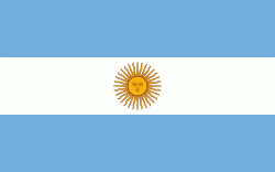
Country - Argentina
 |
 |
| Flag of Argentina | |
The earliest recorded human presence in modern-day Argentina dates back to the Paleolithic period. The Inca Empire expanded to the northwest of the country in Pre-Columbian times. The country has its roots in Spanish colonization of the region during the 16th century. Argentina rose as the successor state of the Viceroyalty of the Río de la Plata, a Spanish overseas viceroyalty founded in 1776. The declaration and fight for independence (1810–1818) was followed by an extended civil war that lasted until 1861, culminating in the country's reorganization as a federation. The country thereafter enjoyed relative peace and stability, with several waves of European immigration, mainly Italians and Spaniards, radically reshaping its cultural and demographic outlook; over 60% of the population has full or partial Italian ancestry, and Argentine culture has significant connections to Italian culture.
Currency / Language
| ISO | Currency | Symbol | Significant figures |
|---|---|---|---|
| ARS | Argentine peso | $ | 2 |
| ISO | Language |
|---|---|
| EN | English language |
| FR | French language |
| DE | German language |
| GN | Guarani language |
| IT | Italian language |
| ES | Spanish language |